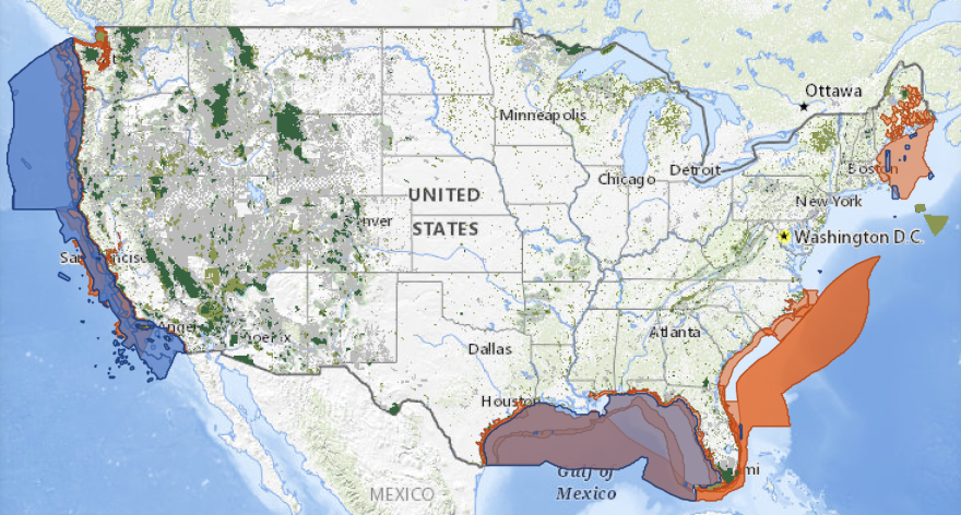
The Biden administration is pushing for the conservation, restoration or protection of 30% of U.S. territory by 2030, and a new website and map tool seek to track progress toward that goal.
The White House announced the launch last week of conservation.gov, a website with resources on conservation efforts across the country. It also houses a beta version of an interactive mapping project called the American Conservation and Stewardship Atlas that visualizes where land is being conserved – from the local to federal level.
“The Atlas is an innovative tool that offers users the ability to view a wide range of scientific information, data, and knowledge on biodiversity, climate change impacts, and equity, with the goal of helping inform and inspire land, water, and wildlife conservation and restoration efforts of individuals, land managers, policymakers, and communities,” the White House said in a release.
The government acknowledged there are gaps in the data, but said the map will improve as new information is added. Drew McConville, a senior fellow at the progressive Center for American Progress think tank, says that much of the data is already publicly available, but scattered among different agencies.
“And trying to bring that all together in one place is a mammoth undertaking,” he said. “And this is a start.”
The government says it still needs better data on Tribal, state and private conservation efforts – as well as on biodiversity and federal protected areas. Beyond conservation, the map includes layers on animal migration and habitats, nature-deprived communities, weather and climate, and many more.
This story was produced by the Mountain West News Bureau, a collaboration between Wyoming Public Media, Nevada Public Radio, Boise State Public Radio in Idaho, KUNR in Nevada, KUNC in Colorado and KANW in New Mexico, with support from affiliate stations across the region. Funding for the Mountain West News Bureau is provided in part by the Corporation for Public Broadcasting.


