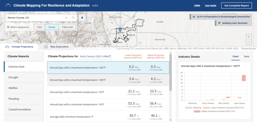
The Biden administration launched a new website this month that provides interactive, real-time information about hazards such as wildfires, drought and extreme heat.
“We're trying to make it easy for non-experts to find and use decision-relevant federal data to map and understand their exposure to climate-related hazards,” said Tom DiLiberto, a climate scientist at the NOAA Climate Program Office.
The web portal, called Climate Mapping for Resilience and Adaptation, combines climate maps and data from several federal agencies with non-climate data like building code standards and social vulnerability information.
The site's Assessment Tool allows users to zoom in on specific locations to see projected future climate conditions. For instance, Denver's average daily maximum temperature was historically about 65 degrees. Under an optimistic emissions scenario, that temperature is projected to reach about 68 degrees over the near term, and exceed 70 degrees by the end of the century.

DiLiberto said the long-term context can inform decision-making among organizations and governments, from the local level on up.
“There are no short-term fixes,” DiLiberto said. “This is a problem that has to be looked at over a long period of time. And this is one way to start along that process of really assessing the climate risk across your communities, as well as providing an extra bit of information to start the process of making sure that your communities are climate resilient.”
The portal also lists federal agencies that offer funding to help mitigate climate-related hazards. DiLiberto said that is key to their mission.
“It's not only explaining to you wherever you are in the country about the relevant climate hazards that could affect you and your community, but it's also then providing avenues for you to look into getting funding – so that you can not only assess your vulnerabilities, but take that next step to also find funding opportunities to take action as you learn about your climate hazards,” he said.
This story was produced by the Mountain West News Bureau, a collaboration between Wyoming Public Media, Nevada Public Radio, Boise State Public Radio in Idaho, KUNR in Nevada, the O'Connor Center for the Rocky Mountain West in Montana, KUNC in Colorado, KUNM in New Mexico, with support from affiliate stations across the region. Funding for the Mountain West News Bureau is provided in part by the Corporation for Public Broadcasting.
Copyright 2022 KUNC. To see more, visit KUNC. 9(MDA1MTkyNjA1MDEyNzM1MTQ0ODk3NTA1NA004))


