-
 Satellites like NOAA and NASA’s GOES constellation have been an important fire science tool for years. Over the summer, the nonprofit Earth Fire Alliance launched the first three satellites of its FireSat program, and the first images taken by them were recently released.
-
 Thick smoke from summertime wildfires can present major health risks. Prediction models help locals prepare for poor air quality to come, but the data…
-
 Boise’s Gowen Field is home base to NASA and NOAA’s newest collaborative research project on wildfire smoke and air quality. Several times a week, teams…
-
 A recent report from NOAA’s National Centers for Environment Information shows there were 14 severe weather events across the country last year costing...
-
 Idaho Rivers United, a member of the consortium of organizations threatening to sue the state over steelhead season, is backing away from the possible…
-
 The federal government's management plan for protecting salmon and steelhead killed by federal dams in the Columbia River basin differs little from its…
-
 The Port of Port Townsend, Wash., is providing a temporary home to a piece of literary history. But the dry-docked sardine fishing boat once chartered by
-
 Civilian use of aerial drones is still greatly restricted, but the federal science agency NOAA has won permission to test a small unmanned aircraft off…
-
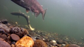 Environmentalists, farmers and irrigators could play a bigger role in creating long term management policies for Columbia Basin salmon and steelhead. The…
-
 Environmentalists, irrigators, and other stakeholders in the Northwest are being offered an expanded role in shaping the long-term recovery plan for…

© 2026 Boise State Public Radio

NPR in Idaho
Play Live Radio
Next Up:
0:00
0:00
Available On Air Stations


