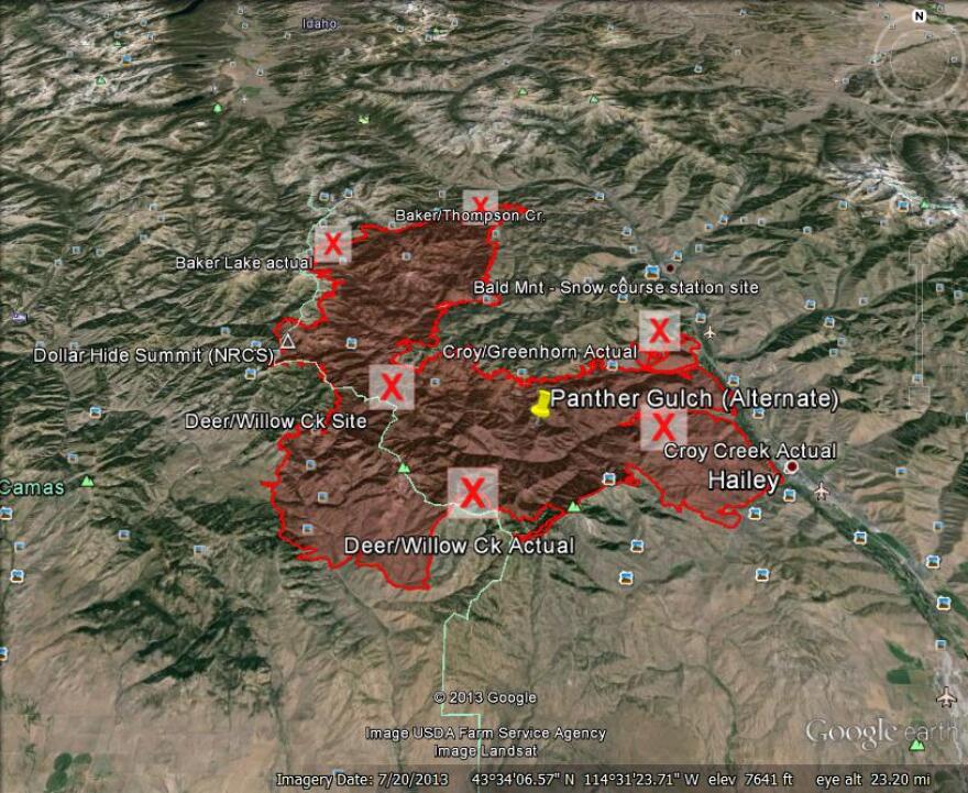
The Beaver Creek wildfire burned 174-square-miles in August and threatened Ketchum and Hailey. After the fire, torrential rains sent mud and rocks down burned mountainsides. Debris hit homes and covered roads.
“Some of these debris flows were 20 to 30 feet thick,” recalls Dave Evetts. He’s the assistant director for hydrologic data at the U.S. Geological Survey’s Idaho Water Science Center in Boise.
Evetts and USGS hydrologist Ken Skinner sit in a conference room looking at computer generated maps that show where the Beaver Creek fire burned. Skinner assessed the potential for future slides in areas that burned this summer and created these maps using computer modeling.
Skinner says modeling efforts have been conducted on several wildfires mainly in California, Colorado, Arizona and New Mexico.
"This is the first modeling effort done on an Idaho fire," he says.
It takes up to a month to create these models although Skinner and Evetts were slowed down by the 16-day federal government shutdown.

Skinner's maps find that areas such as Deer Creek and Greenhorn Gulch are at risk for debris flows when the rains return next year.
The fire heavily burned in Greenhorn Gulch between Hailey and Ketchum leaving the hillsides bare. Heavy rains this fall sent mud and rock slides down into the gulch.
“Your danger for these debris flows is still there for up to three years after the burn,” explains Skinner.
That’s the amount of time it usually takes for grasses, trees and other vegetation to get rooted in the soil. So the Skinner’s computer modeling is good for three years.
Evetts and others have used Skinner’s maps to figure out where to install six precipitation gauges in the spring. Too much water would tip a bucket on the gauge, which would then trigger an alarm and then data would begin to transmit information to agencies like the National Weather Service.
The precipitation network will cost more than $48,000 to install and maintain. Blaine County's Bureau of Homeland Security and the USGS will share the cost.
Evetts says the gauges will go in each spring and be removed each fall before the snows come for the next year.
Copyright 2013 Boise State Public Radio


